AI end-to-end system for Multi-Sensor Pavement Distress Detection
PROJECT TEAM
Prof. Dr. Rehab F. Abdel-Kader
Professor / Principle Investigator (PI)Electrical Engineering Department

Prof. Dr. Mohamed F. Abdel-Kader
Associate Professor (Co-PI)Electrical Engineering Department

Dr. Adel Moussa
Lecturer ResearcherElectrical Engineering Department

Dr. Ahmed Aly Elsharkawy
Lecturer ResearcherCivil Engineering Department

Dr. Emad El-Sayed
Lecturer ResearcherElectrical Engineering Department

Eng. Mohamed Hedeya
Graduate student ResearcherElectrical Engineering Department

Eng. Eslam Samir
Graduate student ResearcherCivil Engineering Department
Project Summary

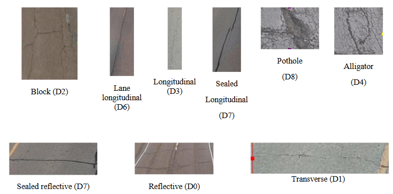
Road infrastructure is a crucial pillar in economic development and growth and brings important social benefits. Egypt has more than 175,000 KM of paved roads with around 24,000 KM of them highway roads. Moreover, In August 2014 Egypt has launched the new-development axis national road project that is set to improve the national road-infrastructure and meet the Egyptians aspirations in a better and safer life. The project includes huge investments for the construction of 5000 KM of new roads and the development and maintenance of the existing road network. The road-maintenance plan involves performing regular manual road-condition surveying which is labor-intensive and prone to the subjectivity of the inspector. Automated road-condition surveying and distress detection systems utilize data acquisition equipment and automated data processing techniques to identify, classify and quantify the different types of pavement distresses. It provides the ideal alternative for distress identification crucial for effective monitoring of road-health status and optimizing the resources required for pavement maintenance planning.

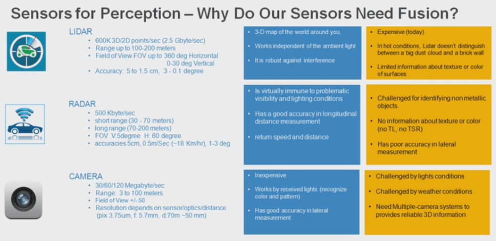
The primary focus of the proposed study is to contribute to the national-road project in Egypt via developing smart and effective solutions to perform automated road-condition surveying. In particular, we propose an effective end-to-end AI system dedicated to the pavement distress detection problem for smart management of national road infrastructures. The proposed system integrates different sensor modalities such as 3D-Laser point cloud data with digital imaging using the high computational capabilities of AI technologies.

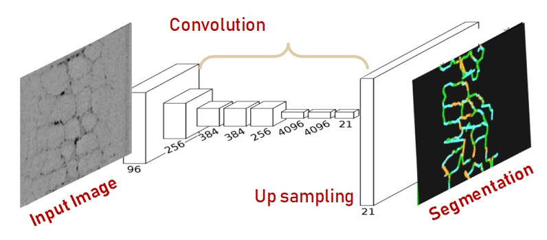
The study will involve the investigation of many research issues such as the feasible deep-learning architectures for multi-sensor data processing and their effect on system performance. In addition, we will examine the tradeoffs between utilizing feature engineering layers based on existing work as opposed to end-to-end deep learning models using raw sensor data. The study will be conducted and tested using self-collected national labeled datasets that provide multi-sensor surface-distress information (3D-sensor data and 2-D images) that can be available for further research problems.

The proposal project research team includes a multi-disciplinary set of researchers with a strong academic record in the different areas of artificial intelligence, machine learning, point cloud processing, and civil engineering. In addition, the project management team has past management experience in managing research projects. Finally, the project utilizes the existing 3D geo-sensing equipment available at Port Said University.

